Καταρράκτης Παρακοίλων - Waterfall of Parakila
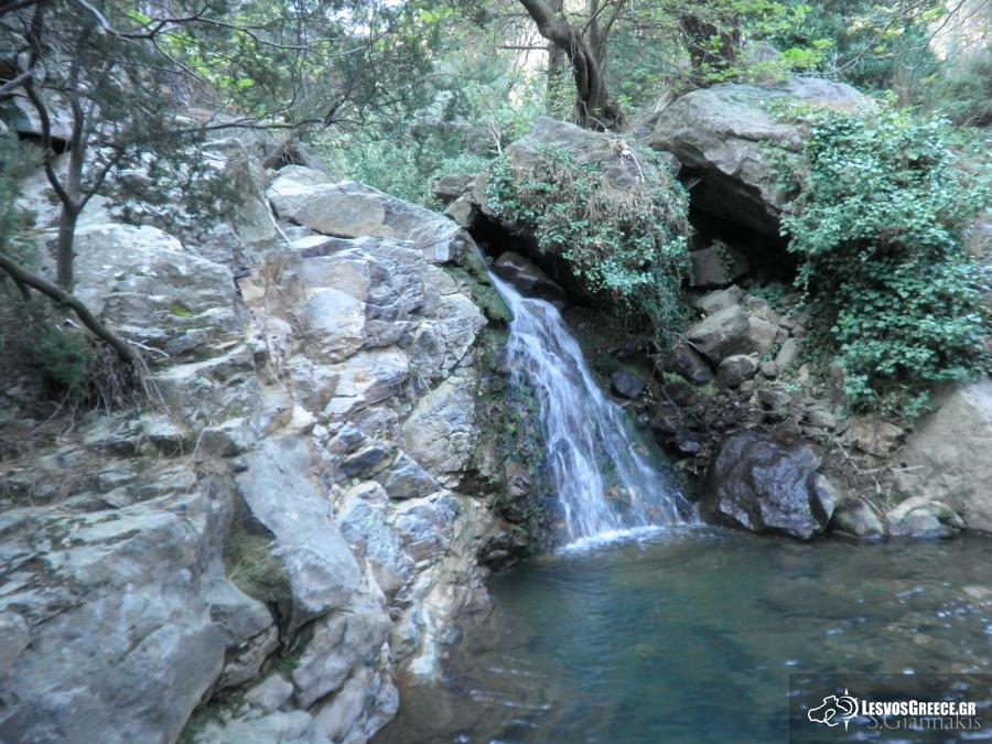
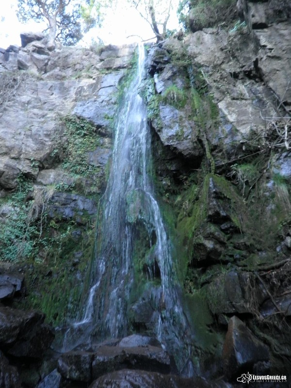
Από τη διασταύρωση προς Βατούσα και Πτερούντα, σε απόσταση περίπου 3 χλμ. από τον οικισμό της Ανεμώτιας, ξεκινά το μονοπάτι που ακολουθεί το χωμάτινο αγροτικό δρόμο για να καταλήξει, έπειτα από μια διαδρομή 12,6 χλμ., στον οικισμό των Παρακοίλων. Η αρχή της διαδρομής, είναι ανηφορική ανάμεσα σε ενδιαφέροντες γεωλογικούς σχηματισμούς και διασχίζει το μοναδικό δάσος μαύρης πεύκης του νησιού. Ύστερα από 4,45 χλμ., φτάνει σε υψόμετρο 620 μέτρα, στο ψηλότερο σημείο του, απ’ όπου ο πεζοπόρος απολαμβάνει τη θέα της κοιλάδας της Ποταμιάς και του κόλπου της Καλλονής. Εκεί, ψηλά στον ποταμό του Ταξιάρχη, πάνω από το χωριό Παράκοιλα και ακολουθώντας το πέτρινο μονοπάτι, ανάμεσα σε ελιές, κουμαριές και πλατάνια βρίσκεται ο καταρράκτης των Παρακοίλων, όπου τους χειμωνιάτικους μήνες τα νερά που τρέχουν μας προσφέρουν ένα μοναδικό θέαμα. Η περιπατητική διαδρομή μέχρι εκεί είναι πολύ ενδιαφέρουσα και αξίζει να την ακολουθήσει κανείς!
From the junction to Vatousa and Pterounta, approximately 3 km from the village of Anemotia starts the path that follows the dirt road to reach, after a 12.6 km route, the settlement of Parakila. The beginning of the route is uphill between interesting geological and traverses the unique black pine forest of the island. After 4.45 km, reaching an altitude of 620 meters, the highest point, from where the hiker enjoys the view of the valley Potamia and Gulf of Kalloni. There, up the river of Taxiarchis above the village Parakila and following the stone path among olive trees, arbutus and trees, is the cascade of Parakoila, where the winter months the water running offer us a unique spectacle. The ambulatory way up there is very interesting and worth to follow it!
From the junction to Vatousa and Pterounta, approximately 3 km from the village of Anemotia starts the path that follows the dirt road to reach, after a 12.6 km route, the settlement of Parakila. The beginning of the route is uphill between interesting geological and traverses the unique black pine forest of the island. After 4.45 km, reaching an altitude of 620 meters, the highest point, from where the hiker enjoys the view of the valley Potamia and Gulf of Kalloni. There, up the river of Taxiarchis above the village Parakila and following the stone path among olive trees, arbutus and trees, is the cascade of Parakoila, where the winter months the water running offer us a unique spectacle. The ambulatory way up there is very interesting and worth to follow it!